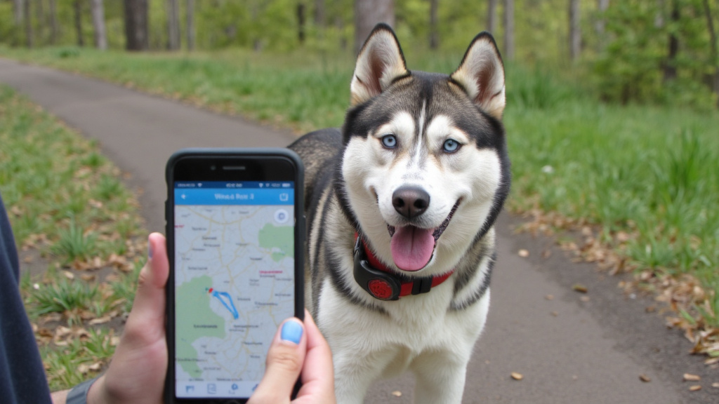
Picture the moment every pet owner dreads: you discover your beloved companion has slipped through a gap in the fence, and panic sets in immediately. Where could they be? Which direction did they go? In these heart-stopping moments, Enhanced Location Accuracy becomes the difference between a frantic citywide search and a swift, targeted reunion. This is a high-precision pet tracking approach that uses multiple satellite networks and signal corrections to deliver more reliable, meter-level location updates—especially in trees, neighborhoods, and other tricky environments.
Traditional pet-tracking methods leave too much to chance, offering only approximate locations that can span multiple city blocks. When your furry family member’s safety hangs in the balance, “somewhere in the neighborhood” simply isn’t precise enough. Today’s pet owners deserve satellite-based technology that delivers meter-level accuracy, real-time updates, and the genuine peace of mind that comes from knowing exactly where their pet is at any given moment.
At Halo Collar, we’ve engineered pet tracking solutions that prioritize real-world reliability through advanced satellite technology. Through partnerships with leading technology providers and extensive field testing, we’ve discovered that precision location data transforms not just emergency recovery, but the entire pet ownership experience.
What “Enhanced Location Accuracy” Means for Pet Tracking
Enhanced Location Accuracy represents a quantum leap beyond traditional GPS tracking. While standard GPS systems typically provide accuracy of 3-5 meters under ideal conditions, advanced satellite technology such as Halo Collar can achieve precision down to 0.6 meters (less than 2 feet) or better, even in challenging environments like dense forests or urban canyons.
This remarkable precision stems from multi-constellation satellite support, allowing devices to connect simultaneously with GPS, GLONASS, Galileo, and BeiDou satellite networks. When your pet explores areas with limited sky visibility, such as under tree canopies or between buildings, this redundancy ensures consistent tracking performance where basic systems fail.
Halo Collar leverages advanced GNSS positioning and is engineered to maintain reliable fence performance even in neighborhoods with tree cover, suburban backyards, and varied terrain. Halo Fences are stored directly on the collar, so your boundaries continue working even if cellular coverage drops.
Signal Processing Excellence
Advanced satellite receivers employ sophisticated signal processing techniques that filter out reflected signals and atmospheric interference. Multi-path mitigation technology prevents the “ghost” readings that confuse lesser tracking systems, while enhanced sensitivity helps maintain satellite lock in challenging conditions.
Real-time corrections continuously adjust for satellite clock variations, atmospheric delays, and signal distortions, so location data reflects your pet’s true position with remarkable accuracy. This processing happens seamlessly in the background, delivering reliable performance that pet owners can trust.
Real-Time Updates: Why Frequency Matters When Pets Run
The value of enhanced location accuracy multiplies exponentially when combined with real-time tracking capabilities. Traditional systems often update location information every few minutes or hours, creating dangerous gaps where a lost pet could travel significant distances undetected.
Modern real-time tracking provides location updates as frequently as every 15-30 seconds, creating a continuous breadcrumb trail of your pet’s movements. This granular tracking serves multiple purposes: immediate alerts when pets leave designated safe areas, behavioral pattern recognition, and most importantly, precise, up-to-the-minute information needed for quick recovery.
Halo’s location updates are designed to refresh frequently while your dog is moving, helping create a clear, readable path in the Halo Collar app. In the app, you can view your dog’s live position on a map and receive notifications if they leave a designated fence.
Adaptive Reporting Intelligence
Smart tracking systems employ adaptive reporting strategies that balance accuracy with battery efficiency. More frequent updates occur when pets are moving, while reducing update frequency during rest periods. Push notifications deliver instant alerts for unexpected movement, ensuring you’re informed immediately when intervention might be needed.
During emergencies, this precision becomes life-saving. Instead of searching multiple blocks, Enhanced Location Accuracy pinpoints exact positions, enabling immediate, targeted rescue efforts and effective coordination with emergency responders or volunteer search groups.
Precision Geo-Fencing for Proactive Protection
Geo-fencing technology transforms from basic alert systems to sophisticated safety networks when powered by Enhanced Location Accuracy. Traditional geo-fencing suffers from “false positive” alerts due to location inaccuracies, training pet owners to ignore notifications that might indicate real boundary violations.
With pinpoint satellite positioning, geo-fences become precision tools that activate only when pets genuinely cross established boundaries. You can confidently create multiple zones: safe areas around your home, alert zones for neighborhood boundaries, and restricted areas to keep pets away from dangers like busy roads.
In the Halo Collar app, you can draw and save multiple GPS fence zones for your home yard, vacation properties, campgrounds, or parks. Halo’s zones are portable and wire-free, allowing you to create boundaries wherever your dog goes rather than being limited to a buried wire installation.
Intelligent Boundary Management
Advanced geo-fencing incorporates intelligent algorithms that learn from pet movement patterns, distinguishing between brief boundary approaches and actual escape attempts. This smart filtering dramatically reduces unnecessary alerts while ensuring immediate notification of genuine violations.
This precision enables complex, customized safety zones that adapt to your lifestyle; different boundaries for different times of day, weekend zones that include hiking trails or dog parks, and irregularly shaped boundaries that follow property lines or natural barriers rather than simple circles.
Halo pairs precision positioning with guided training feedback to help dogs learn to recognize and respect fence boundaries. Rather than simply notifying you after an escape, the collar provides feedback as your dog approaches the boundary, helping reinforce safer behavior over time.

The Psychology of Pet Owner Peace of Mind
Enhanced location accuracy delivers benefits extending far beyond technical specifications, which fundamentally transforms the pet ownership experience. Pet owners equipped with precise, reliable tracking report significantly reduced anxiety and increased confidence in allowing pets freedom to explore and exercise.
This psychological benefit creates a positive cycle: less anxious owners make better decisions, pets enjoy more enriching experiences, and human-animal bonds strengthen through increased trust. When you can locate your pet within seconds using satellite technology, you’re more likely to provide the outdoor experiences that contribute to their physical and mental well-being.
That peace of mind extends beyond emergencies to daily activities. Checking your pet’s location during work hours, confirming they’re safely in the backyard, or tracking exercise patterns becomes effortless, creating a constant connection that benefits both pets and families.
Within the Halo Collar app, pet parents can check location at any time, manage fence settings, and share live tracking access with trusted family members or caregivers for coordinated monitoring. This creates both technical accuracy and practical usability during everyday routines and emergencies.
Key Takeaways
- Enhanced Location Accuracy improves reliability in neighborhoods, wooded areas, and between buildings. Multi-constellation satellite support helps maintain precision even under trees or in dense environments.
- Real-time updates create a live movement trail. Frequent location refreshes reduce search areas and speed up recovery.
- Precision Geo-Fencing cuts false alerts. Accurate boundaries mean notifications trigger when they should, building long-term trust in the system.
- Fewer false alarms = greater confidence. When alerts are reliable, pet owners respond faster and with clarity.
- Best performance depends on smart setup. A secure collar fit, charged battery, tested zones, and enabled live tracking ensure accuracy when it matters most.
Practical Implementation for Maximum Effectiveness
Technology delivers maximum value when paired with consistent habits and proper setup. Simple maintenance steps and routine checks ensure your tracking system performs optimally when you need it most.
Essential Setup and Maintenance
- Establish charging routines: Maintain battery health through regular charging schedules and monitoring
- Verify positioning accuracy: Conduct short test walks to confirm live updates and map alignment
- Update emergency contacts: Keep recovery contacts and veterinary information current in your tracking app
- Test geo-fence functionality: Create temporary zones and trigger them to confirm notification systems
- Configure sharing permissions: Add trusted family members or friends for coordinated response capabilities
Security considerations are equally important. Look for systems offering encrypted communications, controlled sharing permissions, and account safeguards like two-factor authentication. Enhanced Location Accuracy requires protecting location data in transit and at rest, ensuring privacy while delivering actionable intelligence.
Schedule monthly system checks, reviewing battery status, location history, and sharing permissions. This five-minute habit can save hours in emergencies.
Choosing a Pet GPS Tracker: What to Compare
As you compare pet tracking options, understanding the technical foundations helps you make informed decisions. Not all GPS-enabled trackers offer the same precision or reliability, and marketing claims don’t always reflect real-world performance.
Key evaluation factors include multi-constellation satellite support, update frequency capabilities, battery life under continuous tracking, and performance in challenging environments. Look for systems specifically mentioning multi-constellation support, indicating access to broader positioning satellite networks.
Consider the total system approach: tracking accuracy means little without reliable cellular connectivity for data transmission. Advanced systems integrate multiple communication technologies, automatically selecting the strongest available signals to ensure consistent performance even in limited coverage areas.
How to Use Enhanced Location Accuracy in an Emergency: A Mini Recovery Playbook
- If your pet escapes, act quickly and use precision tracking strategically.
- Switch to live tracking mode. Enable the highest available update rate to receive real-time location refreshes and create an active movement trail.
- Share the live location immediately. Send tracking access to family members or trusted neighbors so multiple people can coordinate recovery.
- Start at the last-known location. Go directly to the most recent map pin and follow the breadcrumb trail in order. Pets often pause, double back, or stay within a short radius.
- Notify nearby support with an exact map pin. Share a screenshot or live link with neighbors, local shelters, animal control, or community groups to increase the chance of immediate assistance.
- Bring essentials. Take a leash, high-value treats, a fully charged phone, and remain calm. Precision tracking guides you there; calm energy helps bring your pet home safely.
Conclusion: Precision Technology for Precious Companions
Enhanced location accuracy through advanced satellite technology has revolutionized pet tracking, transforming it from basic emergency tools into comprehensive safety and peace-of-mind solutions. The key benefits include:
- Pinpoint precision that eliminates guesswork during pet recovery efforts
- Real-time tracking capabilities that provide continuous monitoring and immediate alerts
- Intelligent geo-fencing that creates customizable, reliable safety boundaries
- Psychological benefits that reduce anxiety and enhance pet ownership experiences
- Advanced technology features that ensure consistent performance in diverse environments
The difference between basic GPS tracking and Enhanced Location Accuracy isn’t measured solely in meters of precision; it’s measured in confidence, peace of mind, and strengthened bonds between pets and families. When every second counts and every meter matters, advanced satellite technology delivers the reliability pet owners need and the protection pets deserve.
Ready to experience the difference precision tracking makes? Visit Halo Collar to discover how enhanced location accuracy can transform your approach to pet safety and bring greater confidence and peace of mind.
Frequently Asked Questions
How accurate are Halo Fences compared to other “wired” fences?
Halo Fences use Halo’s advanced GPS/GNSS system, which is extremely accurate and more precise than typical smartphone GPS. They don’t rely on buried wires, so they can’t be cut or damaged and don’t require underground installation. Halo Fences can be placed anywhere and aren’t limited by geography or obstacles that make wired systems difficult to install.
Will Halo work when I am out of cellular or Wi-Fi coverage (i.e. while camping or hiking in a remote location)?
Yes. Halo Fences are stored directly in the collar’s memory before you leave, so they continue working even in zero cellular or Wi-Fi coverage. The collar does not lose your fences if it loses power or an internet connection.
How does Halo keep my dog safely contained inside my Halo Fence?
Halo uses a patented, dog psychology-based method developed by Cesar Millan that provides customized feedback as your dog approaches a boundary. Your dog learns to associate this feedback with the “Keep Away” command. If the dog continues toward the boundary, escalated feedback is given until they respond. Once they turn back, a “Come Back” encouragement command guides them safely back inside the fence.
How is Halo different from other “smart” collars?
Halo combines GPS fence containment with training and feedback based on dog psychology, not just tracking. It actively guides your dog with escalating cues (sound, vibration, or static) and uses two-way communication that works continuously to contain and coach your pet rather than merely alerting you after an escape.
Do I need cellular service for real-time tracking?
Real-time location updates and changes require cellular or Wi-Fi to transmit data between the collar and app. However, Halo Fences themselves remain active even without coverage once they are stored in the collar’s memory.
How often do GPS collars update location?
Halo Collars analyze multiple location updates per second, providing real-time tracking that refreshes frequently enough to follow a dog’s movement accurately in the app.
What’s the difference between GPS and multi-constellation GNSS?
GPS refers to the U.S. Global Positioning System. Multi-constellation GNSS means the collar can connect to multiple global satellite networks (such as GPS, GLONASS, Galileo, etc.), increasing overall accuracy, reliability, and performance in challenging environments compared with single-system GPS alone. While Halo’s product details refer to advanced GNSS accuracy, the fundamental difference is broader satellite access and better positional precision.